The current issue of the Blog is presented as a brief introduction to the Automated Identification System (AIS). The following issue will deal with the use of AIS to circumvent the imposed restrictions on the shipment of crude oil by Iran.
AIS: THE BASICS
The efforts of John Harrison and the development of the sea going chronometer is of prime importance in the annals of seagoing history. The development and implementation of the Automatic Identification System (AIS) does not have the impact or utility of Harrison’s efforts, but its positive effect on maritime safety is without equal. Automatic Identification System (AIS) is a maritime navigation safety tool that uses radio signals to exchange real-time information between ships, shore stations and satellites. It aids vessels in identifing and track nearby ships preventing collisions and enhances internship communication. It is designed and incorporates features found in use by commercial aircraft. It provides essential information about nearby vessels, their position, speed, and course and enables better decision-making and reduces the risk of accidents.
AIS equipment uses Very High frequency (VHF) radio transceivers that broadcast and receive information about the positioning and identification of vessels. The radios communicate on two VHF frequencies: 161.975 MHz and 162.025 MHz and have an effective range of 50 miles.
The International Marine Organization (IMO) requires ships weighing 300 gross tons or more to be fitted with AIS equipment when on an international voyage. The regulation also apples to cargo ships of 500 gross tons or more involved in local voyage and to all passenger ships.
The transmitters broadcast information at regular intervals depending on local radio activity A ship AIS system transmits navigational data every two to 180 seconds and broadcasts voyage data every six minutes.
AIS transponders on nearby ships or on land receive these signals and the information is displayed either on radar or on chart plotters, showing ships’ position and navigation information. When other ships and maritime traffic know these key details, they ensure traffic follows a safe course and prevent collisions. It is not necessary for ships personnel to physically see other vessels in order to avoid collisions.
With the broadcasted information personnel can call any ship over VHF radiotelephone by name, rather than by “ship off my port bow” or some other imprecise means.
The following data is transmitted by VHF radio every 2 to 10 seconds while a vessel is underway and every 6 minutes while a vessel is at anchor or underway.
BROADCAST EVERY 2 TO 10 SECTONDS WHILE UNDERWAY
Vessel Maritime Mobil Service ID
Rate of turn, right or left
Navigation status, “at anchor, under way, etc”
Speed over the ground
Position location
Latitude
Longitude
Course over the ground
True heading
True bearing at own position
UTC
BROADCAST EVERY 6 MINUTES WHILE UNDERWAY
IMO (ship ID)
Radio call alert on VHF
Name of vessel
Type of ship
Dimensions of ship
Location of positioning system aboard ship
Location of antennas on ship
Draft of ship
Destination of Ship
EST of Vessel to Port
Optional – Request for further time information.
COMPONENTS OF AN AIS SYSTEM
AIS Transponder
The heart.of the the AIS system, responsible for the transmitting and receiving data. It sends out information, such as identification, position, course, and speed. It receives data from other AIS equipped vessels and shore based stations..
AIS DISPLAY
Present AIS data in a user friendly format, Integrates AIS data into other navigation systems, such as Electronic Chart Displays or radar or can function as a stand alone device. It enables mariners to visualize the position and movements of nearby vessels.
VHF RADIO
Transmit and receive AIS data over two standard VHF marine frequencies.
GPS Receiver
Generate position data for AIS system.
BENEFITS OF AIS ONBOARD SHIPS
AIS provides real-time information about nearby vessels, helping mariners assesses their surroundings.
Allows for better decision-making and proactive navigation adjustments
Reduces the risk of accidents caused by limited visibility or human error.
ENHANCED COLLISION AVOIDANCE
AIS data enables mariners to identify potential risk early
Facilitates communication between vessels to coordinate safe passage
Complements traditional navigation methods: radar and visual observation.
EASIER COMMUNICATION WITH OTHER VESSELS
AIS simplifies the process of contacting nearby ships by providing their identification and call sign.
Promotes communication from near by ships by providing their identification and call sign.
Promotes efficient communication and cooperation between vessels.
Reduces the risk of misunderstanding and miscommunication that can lead to accidents.
—///—
The author-owner of this blog retired from the Special Projects Unit of the US Naval Oceanographic Office. He has worked for Navy contractors dealing with Underwater Systems. His special interest is Oil Tankers, especially the T2 type Tankers developed during World War II. He has published articles dealing with maritime history and was a Volunteer Staff Aid in the Navy-Maritime Section of the National Archives and Records Administration in Washington, DC.
Previous Post:
MAJOR PERSIAN GULF PORTS
With increasing world trade in petrochemicals the precursor of these items, crude oil, has assumed significant trade importance. Ports in Southeast Asia and the Persian Gulf have increased their ability to handle crude oil and are leaders in the shipping industry relative to efficiency and volume.
The Persian Gulf Ports, Jebel Ali, Jeddah, Salalah, Sajah/Khor Fakhan, Bandan Abbas, and Damman are considered among the world’s largest container ports. Ports in the Persian Gulf are leaders in efficiency and productivity. The willingness of sovereign bodies to stand behind the investments of key port improvements ls a significant factor in status ranking. The volume of goods passing through the ports of the six main gulf states rose from 15 million TEU’’s in 2004 to 24 million TEUs in 2008. This growth served as as a major incentive for these Gulf nations to further increase their ability to handle the containers now used in maritime shipping .
{TEU] A containership’s capacity is measured in TEU’s or 20-foot equivalent units. A 40-foot container is measured as equal to 2- 20 foot containers. In 1936 when Malcom Land designed an intermodal container the original container was 20 foot long. Containers were over several years reconfigured to have a 40 foot length and are now a standard size. Two 20 foot containers are approximately equal to a 40 foot container. At best the equivalents are an approximation.
SAUDI ARABIA
Saudi Arabia occupies most of the Arabian Peninsula and is a major trading partner with countries in the region as well as internationally.
Jettah Port
Located in the middle of international shipping routes connecting the east to west Jettah is crucial to Saudi Arabia’s financial capital and in addition is one of the busiest ports in the region. It handles 65% of the countries imports and It contains massive warehouses and has the ability to store crude oil awaiting export. It has 35 multipurpose and 8 oil terminal berths In addition Jettah has 20 dedicated container berths. Jetta Port is considered as one of the world’s foremost shipping centers..
Dammam Port
The Dammam area, unlike other oil Ports, has developed in multiple fields, including hosting the overall administration of the Saudi oil industry. It is also a contemporary urban and industrial cente. It is the second busiest port in North Africa and the Middle East and the largest port within the Persian Gulf. It handles a large amount of the export services for the oil industry The port has a frigerated cargo terminal and a bulk grain terminal and two container terminals. It also contains a residential complex for employees. It is a self-sufficient port. Saudi Arabia’s King Abdulaziz Port section of Dammam sets a new record by handling 199,609 TEUs (twenty-foot equivalent units) of containers in August 2022. This record-breaking performance of the port is attributed to the rise in export and import volumes, as the Kingdom moves in line with the strategy aimed at turning Saudi Arabia into a global logistics hub. The Port has 9 container berths and 15 Quay cranes.
Yanbu Port
Yanbu is a major crude oil handling port in the nation and the Red Sea. It sends crude oil and refined products north to Europe. It is situated in a prime location between Europe and the Suez Canal as well as the Bab El Mandeh Strait and the Far East. It has 34 berths for general cargo, container and Ro Ro vessels. Because the port handles very large amounts of crude oil most of its berths are devoted to very large tanker vessels.
Jubail Port
The port is composed of two very different sections – an Industrial,port which is the main
import source of the raw materials that go into the city. It also handles the exports from the industrial city to the regional and industrial markets. It handles different types of refined
Petroleum gas products such butane and propylene, chemical fertilizers and iron ore cargo.
The commercial port handles general and bulk cargo. It has a capacity of of 1 million TEUs per year. The port has simplified its operation into three main terminals –a container terminal, with 4 berths, a general terminal with 8 berths and the bulk terminal with 4 berths.
Gizan Port
The port of Gizan located on the southern Red Sea coast. It is a mid-sized modern and well equipped width equipment that handles large sized container cargos. It has handled over 800 containers in 2009.
Ras al Mishah Port
Located on the northeast coast of Saudi Arabia the port serves the military city of Al Batin. The port can manage containers, dry bulk and is capable of managing break bulk cargos.
Ras Tanura Port
Located near the city of Dammam, on the northeast coast of Saudi Arabia, it is situated on the main highway of the country. It has numerous berths for the loading of crude oi and is considered as the main terminal in the Gulf for the export of crude oil. The also port handles military equipment.
Dhuba Port
The port is located on the north-west area of Saudi Arabia and is the closes port of the country to the Suez Canal and the route to Greece, Turkey, and French ports. The port receives passengers and cargo shipments and is equipped with modern gear that can handle different types of cargo.
IRAN
The Republic of Iran is located at a major crossroad of the middle east and is situated on the shores of the Persian Gulf, along a route of merchant ship traffic that serves a multitude of countries. Though it has vast amounts of oil and gas reserves it is considers to be middle-income nation. It has a diversified economy that is based on the export of oil though its Persian Gulf ports.
Port of Bandar Abbas
Its chief exports are chrome ore, cotton carpets, patorium products. Its chief imports are cotton goods tea, sugar, fertilizers, grains, construction equipment and until recently gasoline. The port handles about 1,000,000 TEUs annually.
The Port is divided into two adjacent sections, the central port and the old port of Bandar Abbas.
Shahid Bahonat
Apart from a merchant port it also serves as a naval base. The merchant port serves as terminal for moving goods to and from Central Asian countries. The port has trade links to Europe, Africa, Southeast Asia and the Americas. The main port, referred to as the Shahid Rajaee Port lies at the foot of the Gachin Mountains to the west of the city. Ten percent of the Port is devoted to warehousing. Expansion of the port facilities is underway. The port has ten general cargo berths with a water depth of 12 meters. It has 5 container berths and a grain storage facility. Petroleum products are handed at two wharves under private ownership. It has a RORO site and a passenger terminal. The port can handle 100,000 dwt bulk vessels and 80,000 dwt tankers. The Old Port is situated to the north of Qeshm Island and covers 31 hectors, nine of which are warehouses. The port supports the biggest oil refineries in Iran. It has an ore-loading berth measuring 200 meters. It. also has a passenger terminal and a barge facility.
PORT OF CHABAHAR
This port has access to Iran proper and to the Indian Ocean without having to transit the constricted Strait of Hormuz. It has the capability to become the major transport hub for Iran. Ships offload bagged grains and cargo containers at the pier as well as unloading in the offshore anchorage and taken to the port in barges. India has played an important part in the development of the port. Approximately 1,400,000 tons of cargo and over 1,600 vessels visit the port annually. Since it is close to Afghanistan, Pakistan and India have a key role in the ports development. Two berthas were developed by India. The Shahid Behwshti portion of the Port consists of 2 container berths that can accommodate ships carrying 4000 TEUs with a draft of 16 meters. It has 3 multipurpose berths that can accommodate 100,000 DWT cargo ships. Additional berths were constructed that increased the ports capacity to 8.5 million tones. . The Shahi Kalantan part of the port has 5 berths that can accommodate four additional vessels and barges while the fifth can handle 40,000DWT ships.
IMAM KHOMEINI PORT
Located at the head of the Persian Gulf this Port receives oil tankers, and container vessels. It is the most modern port in Iran . It can handle shipping containers as well as general cargo. It is a major petrochemical shipping port. An added feature of its importance is its location on the nation’s major rail line. It is recorded as 16,500,000 tons of cargo, 40,300 TEUs of containers and 6300 passengers a year. Its railway is linked to the national railway system and its adjoining highways are linked to the major industrial centers of Iran and eastern Europe. The port offers docking and repackaging services. The port is undergoing expansion and plans are underway to add a shipbuilding dry dock and adding additional wharves.
Khrag Island Port
Khrag Island is the major shipping point for Iranian crude oil. It loading ability is world class and is equal to any such facilities in the world. The export values are considered secure by the Iranians government and are not available to the public.
KUWAIT
The nation has a long coastline of about 500 km and has become a major shipping center. Its location has enabled the nation to rely on its maritime trade to aide its economy and it is second only in value to its crude oil sales. The port Authority of Kuwait supervises all port activity and is responsible for the operation and management of three of the ports in the country.
Shuwaikh Port
Shuwaikh is the primary port of the nation and is located in the heart of Kuwait City. It is equipped with moderate facilities and has 21 berths, 14 of which have a depth of 10 meters, four with a depth of 8.5 meters and three with a depth of 6.7 meters. The access channel is 8 km in length and has a depth of 9.6 meters at high tide and a depth of 7.5 at low tide. The Port has four major deficiencies:
- Empty container storage space
- Storage areas for cargo
- Number of berths
- Access Roads
The port is handicap by the lack of systematic maintenance and has suffered from the reduction of ship traffic.
Shuaiba Port
The port is set up to handle both container and crude oil tanker vessels. The port has 20 berth with depths ranging between 19 and 14 meters. Four berths handle container vessels. The oil loading pier has a water depth of 16 meters. Shuaiba port is located south of Kuwait City and is the largest port capable of handling container traffic. The port is surrender by industrial plants including a petroleum refinery, petrochemical plant, a cement plant, and a desalination facility and a power plant.
The port was built 30 years ago and most of its facilities no longer meet current standards. However plans are under way to upgrade its facilities to meet current standard.
Doha Port
The coastal port has a controlling water depth of 4.3 meters and the port handles chiefly barge and coastal trading vessels.. Port access is controlled by wave conditions external to the inner harbor. Doha Port is located close to tourist destinations. There is a cruise Terminal equipped to handle both immigration and custom matters. The port is also equipped to handle any type of loading or unloading cargo.
Mubarak Al Kabear Port
There is a new port under construction on Boubiyan Island that is apart of China’s Belt and initiative in Kuwait. The port will have 24 berths with capacity of 8.1 m TEUs. The port will also have its own power plant. The plant is 50% completed.. It is the largest project underway in Kuwait.
UNITED ARAB EMIRATES
Port of Jebel Ali (Dubai)
The best known port in the Unite Arab Emerates is the Port of Jebel Ali. The port is considerate as one the largest manmade harbors in the world and its container traffic rivels Singapore and Rotterdam. The port ranks ninth largest worldwide and is the largest container port in the middleeast. It is a major trading partner with countries in the region as well as internationally. Its port is crucial to the area economy. Jebel Ali handled over 21 million containers a year. The port has a general cargo terminal and a container facility. The port was constructed in 197? as a supplement to Port Rashid. The prime features of Jebel Ali are its storage facilities which play a critical part in its reputation as the chief trade center in the Middle East.
Port of Mina Zayed (Abu Duhabi)
Port of Mina Zayed has been the chief sea port of the capital City of Abu Dhabi for 49 year. The Port is one or the major commercial ports serving the city and has the ability to handle up to ten oceangoing vessels at a time. The port has also acquired the status of a cruse vessel hub along with its bulk cargo cargo service.
Khor Fakkan Port (Sharjan)
Khor Fakkan is a leading world class container transshipment port. It is located three hours away from the container set up facility and is situated in a leading location to serve as a trade port. It serves as a port for cargoes from the Arabian Gu;f to the Indian subcontinent and East Africa. The port features a deep-water harbor that serves both cruise and merchant ships.
INTERESTING WEB SITE
Google Earth (https://earth.google.com/)
Offers the ability to see the world from above with high-resolution satellite imagery, Explore terrain and buildings in 3D for hundreds of sites. Ability to dive down to street and ground level with 360° perspectives. Measure distances. View physical changes in areas of interest by viewing an extensive library of satellite images. It’s free. Use of the program is mostly intuitive but help is available for its many fractures in a free User guide.
(https://earth.google.com/intl/ar/userguide/v4/index.htm)
– NOTE –
The next issue of the blog will deviate from its stated theme, Persian Gulf Oil, in order to examine the “AIS” (Automated Information System) designed expressly for the safety of ship’s navigation. The following issue will return to the central them, Persian Gulf Oil, and examine the means AIS is used to avoid imposed sanctions on the shipment of crude oil.
–
BIOGRAPHY OF THE AUTHOR
The author-owner of this blog is an Oceanographer. He has worked for Navy contractors dealing with Underwater Systems. His special interest is Oil Tankers, especially the T2 type Tankers developed during World War II. He has published numerous articles dealing with maritime history and was a Volunteer Staff Aid in the Navy-Maritime Section of the National Archives and Records Administration in Washington, DC
—-////—-
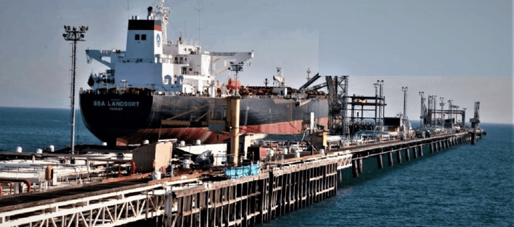
THE TRANSPORT OF CRUDE OIL BY TANKER
A crude oil tanker is a vessel built specifically for transporting crude oil as opposed to refined oil products such as kerosene or gasoline. The owner of the tanker leases his vessel under a complex agreement with oil marketers, chemical companies, or others such as contractors often representing a government or business endeavor . The terms of the vessels agreement varies and is a function of the voyage length, the quantity of oil transported and the route the vessel takes. The contract also includes items related to operational expenses, such as fuel costs, crew payments and insurance of both the vessel and its cargo.
OWNERSHIP NUMBER OF TANKERS SHARE OF WORLD FLEET
Independent 3,588 84%
Oil Company 108 6%
State Owned 418 5 %
State Company 211 5%
Total 4,355 100%
Crude oil tankers come in various sizes, the biggest size being a “Very Large Crude Carrier – VLCC”. This type of tanker carries up to 2 million barrel per shipment. The second largest size is the “Suezmax. taking half that amount of crude and the largest size ship that can transit the Suez Canal fully loaded. The smallest size of crude oil tankers is an “Aframax” that can carry 600,00 barrels of oil. There are smaller tankers but they are used to transport refined oil products such as fuel oil and not crude oil. The means of the transporting crude oil is done by a dedicated oil tanker in order to maximize economies of scale based on volume per voyage. Engine fuel is the largest component of a ship’s operating cost. In 2004 the average fuel cost for a VLCC (Very Large Crude Container) was $14,400 per day. Expenditures on the crew represents the largest amount of non-fuel costs and amounts to about 46 percent of the total cost of the ship’s operation..
The cost of transporting oil via tankers is influenced by the amount of “slack capacity”, defined as the unused tankers available in the market. The shipping industry considers 90 % use of the tanker fleet as “full utilization”. In 2004 the worlds’ fleet of tankers in use neared 100%, resulting in record high tanker contract rates. Rates for oil shipped to Japan by Tanker during this period rose from $35,000 per day to $135,00 per day.
A surplus of crude oil production leads to a decline in oil prices and an opportunity for users to stockpile oil selling at a lower price. This results in a high demand for tankers to move large amounts of less expensive oil – a plus for the tanker market.
Along with oil supply, geopolitical developments play an important role in tanker operations. As Iran emerges from imposed international sanctions it is expected to boost production to match pre sanction levels. A resultant plus to the Tanker market is an increase in traffic to the nations bordering the South China Sea. Competition among ships fueling centers scattered across the earth also impacts ship’s
fuel prices and oil revenues. Because of increasing competition from such ports as Rotterdam, the Russian port of St, Petersburg was forced to drop its fuel prices, but tankers benefit little as this action is generally passed on to end customers.
The refining process takes crude oil as an input, and produces oil based products ready for retail consumption. Depending on the type of crude oil refined, the process creates sellable products like naphtha, asphalt, lubricants and kerosene. Different types of crude oil is routed to refiners in countries where there is a demand for these refined products. Kerosene is used in India as a fuel. Crude from the Middle East is especially suited for creating kerosene and as a result more Middle Eastern crude oil is shipped to Indian refineries.
Barrel Capacity Length (M) Draught (M) Fleet Size
VLCC 2,000,000 320 20 735
Aframax 600,000 265 15 959
Suezmax 1,000,000 285 23 ?
The petroleum industry regards the shipment of crude as part of its inherent logistical expense.
The consumers of crude oil are the major oil National Companies such as Unipec, Saudi Aramco, Petrobras, and international Oil Companies such as Total, Shell and Chevron and trading houses such as Trafigura and Glencore and the large independent refiners (Velero). When a charterer requires a tanker to move oil from A to B he will typically contact a ship broker, who will in turn contacts a number of vessel owners and acts as a middle man in negotiating price, terms and conditions for carrying the oil cargo.
A number of vessels will be eligible to take a cargo and the broker who has been tasked by the cargo owner to find a vessel to carry the cargo muct make the selection. Over time the number of eligible ships decreases as vessel drop out of the bidding process for a number of reasons – logistics, price, and other cargos available to bid on. Worldwide production of crude oil rose from about 73 million barrels in 1988 to about 93 million barrels in 2019 before dropping by more than five million barrels the following year. While accounting for less than 10 percent of global oil production, the Asia-Pacific region is the largest consumer of oil; over a third of worldwide consumption is concentrated in that region..
The tanker industry is highiy regulated in order to ensure that all vessels, and their cargos, are environmentally safe and not a hazard to the ship’s crew. Until the age of 15 years tankers are required to undergo annual safety inspections by independent and recognized international organizations.
Construction of these large crude oil tankers takes 9 to 15 months from the time the keel is first laid. It will take about two years from the time a contract is signed until the vessel is delivered. Many of the critical parts require long lead times and need to be ordered and manufactured before the vessels construction is started. The size of these vessels requires special ship yards capable of undertaking their construction. Their sheer size dictates that only a limited number of shipyards, concentrated in Asia, specifically in South Korea, China and Japan undertake their construction. The price for constructing a VLCC is influenced by a number of factors such as the price of steel, labor costs and available construction finance. The relative demand for contracting new tonnage also plays a role and may lengthen or shortens waiting time. Over the past ten years the cost of a new VLCC has ranged from about 80 million USD to160 million USD. Payments schedules for these ships are typically a 20 % deposit on signing the contract, 20% to 40% in stages of construction and finally 50% to70% on delivery.
Ship Inspection programs address concerns about sub-standard shipping in the oil industry. As part of a risk assessment programs physical inspection of the oil tanker is performed by accredited inspector every six months and resulting reports are is available to charters, ship operators and government bodies.
The economic lifespan of an oil tanker is generally considered to be 25 years, although recently this has dropped to 20 years. Different tanker companies operate with their own depreciation polices ranging from 18 to 25 years.
Listed below are the five largest Oil Tanker transportation companies, all limited to publicly traded companies in the U.S. and Canada.
Scorpio Tankers Inc. (STNG) NYSE. Based in Monaco. Went public in 2010. Provides marine transportation worldwide. Operates more than 100 vessels.
Frontline Plc (FRO) NYSE . Based in Cyprus. Operates 22 VLCC tankers, 26 Suezmax and 20 Aframax tankers.
Teekay Corp (TK) NYSE. Based in Canada. A holding company
Tsakos Energy Navigation LTD NYSE. Based in Canada. Has a fleet of 66 crude oil and natural gas tankers.
SFL Corp LTD (SFL) NYSE. Based in Bermuda. Operates 14 crude oil tankers.
Note
The price of gasoline refined from Middle East crude oil at the pump of local retail (USA) gasoline stations includes a shipping cost of 2 to 3 cents per gallon .
—///—-
BIOGRAPHY OF THE AUTHOR
The author-owner of this blog is a Physical Oceanographer who retired as Head of the Special Projects Unit of the US Naval Oceanographic Office. He has worked for Navy contractors dealing with Underwater Systems. His special interest is Oil Tankers, especially the T2 type Tankers developed during World War II. He has published many articles dealing with maritime history and was a Volunteer Staff Aid in the Navy-Maritime Section of the National Archives and Records Administration in Washington, DC.
SEPTEMBER 14, 2019: REVISITED
Suspected drone attacks on key oil installations in Saudi Arabia have upset world energy markets, spiked regional tensions, and provoked threats of military action by the United States. The September 14, 2019 drone attacks have disrupted about half of Saudi Arabia’s oil production — roughly 5 percent of global supplies — the largest disruption of world crude supplies on record.
On 14 September 2019 at 4 am a fleet of drones and cruise missiles attacked the Saudi Arabian Abqaiq Terminal, its major oil treatment facility and Khuraisa, the principal oil field of the Saudi Aramco Company. The attack originally was thought to be the work of Iranian backed Yemen rebels and several news outlets in their early editions placed the blame for the attack on these Iranian backed rebels. The Yemen Houthis rebels had conducted numerous drone strikes inside Saudi Arabia in the past, but there were a number of reasons to question their latest claim as the source of the drone and missal weapons attacking the Abqaiq and hurais instillations. Further investigation and examination of the debris field left by the weapons detonations pointed to the source of the attack as originating from northern Iran.
Saudi Aramco described its Abqaiq oil processing facility in Buqyaq as the largest crude oil stabilization plant in the world. The facility processes sour crude oil (high sulfur content) into sweet crude (low sulfur content). It can process up to 7 million barrels of crude oil a day, two thirds of the total Saudi output.
The Khurais oil field is believed to produce over 1 million barrels of crude oil a day. It has an estimated reserve of over 20 billion barrels of oil, according to Aramco.
While past events indicate the rebels have conducted numerous drone attacks in Saudi Arabia proper there were a number of reasons to question their latest claim of attacking these two prime Saudi targets.
The missile strike caused large fires and serious damage to the Abqaiq and Khurais facilities and both of the instillations were forced to shut down. This action was responsible for cutting production about 5 percent of global oil output causing marked destabilization of the financial market. The Ministry of Energy stated the country would tap into its reserves to maintain expected levels. The facilities returned to full capacity by the end of September.
Aramco reported fires at its Abqaiq plant and several hundred kilometers away at its oil fields at Khurais. The fires were contained in a few hours and no fatalities were uncovered. Guard at the two facilities tried to bring down the drones with machine gun fire but as expected failed.
Satellite images of the Abqaiq facility appear to show 19 strikes: 14 that punctured storage tanks, three that disabled the oil processing gear, and two that damaged no equipment. According to Aramco, the drone strikes were in at least two waves. As fires in Khurais were, a second wave of drones struck the facility.
Saudi Arabia’s missile defense system failed to stop the swarm of drones and cruise missiles that struck its infrastructure. It’s known that Saudi Arabia had at least one Patriot missile defense system in place at Abqaiq. However, this missile defense system was designed to counter threats of ”high flying targets. ’ Unmanned aerial vehicles and cruise missile fly at an altitude too low to be detected by conventional radar systems. A swarm of drones and cruise missiles coming from multiple directions can confuse and jam radar as well as overwhelming most air defenses. In addition to the Patriot system, at least four shorter-range defense systems were present, yet these also failed to detect and mitigate the drone attack. Drones are too difficult to detect by traditional methods. Drones are cheap and extremely accessible. The drones used by Iran may have cost about $15,000 or less to build and the cost is very favorable to the attacker, meaning Saudi Arabia would have to spend far more than the enemies to protect against additional strike capabilities.
The Center for Strategic and International Studies had warned that the sites of the attack were a vulnerable target, An Israeli defense authority referred to the attacks as “Saudi Arabia’s Pearl Harbor”
Officials of the United States rejected the Yamani rebels claims and instead said that Iran was responsible for the attack. In the months prior tension between Iran and the United States created a crisis in the Persian Gulf and coupled with Irian’s violation of the Join Comprehensive Plan of Action related to their nuclear efforts. The U.S. President initially stopped short of blaming Iran for the attack, saying in an 18 December interview it was looking like “Iran was behind the attack”.
On 17 September 2019 a US official had identified the location in Southern Iran from which it was believed the drones and cruise missiles were launched.
Third-generation drones were launched from one position, and 3 drones from a second position, and from a third position was launched a newly developed drone which used cluster weapons capable of dropping four accurate and independent targeted bombs. Coupled with Saudi evidence U.S. Officials stated the some of the weapons were launched from the Iranian Abvaz Air Force Base, about 400 miles from the targets and flew through Kuwaiti air space..
In summery the outcome of the drone attract can be stated as:
* Oil Processing facility repairs will cost as much as hundreds of millions of USD
* Aramco oil exports were disrupted by 5.7 million barrels a day
* Saudi stock market values plummet
* Spike in oil prices
* Aramco to affect repairs and resume oil production by end of September
— /// —
NOTE
Iran and Saudi Arabia announced a Chinese-brokered deal to restore relations. After decades of enmity and a formal cutting of ties in 2016, the agreement has been touted as a momentous development in the region. But how it ultimately impacts the Middle East remains a very open question, as the long adversarial powers are fighting a proxy war in Yemen and continue to support opposing sides across the region. Amid perceived U.S. actions in the Middle East, the deal is a diplomatic win for China as it increasingly seeks to present an alternative vision to the U.S.-led global order.
—-///—-
AN INTERESTING WEB SIITE
Piracy and Armed Robbery Map 2023
https://icc-ccs.org/piracy-reporting-centre/live-piracy-map
–///–
BIOGRAPHY OF THE AUTHOR
The author-owner of this blog is a Physical Oceanographer who retired as Head of the Special Projects Unit of the US Naval Oceanographic Office. He has worked for Navy contractors dealing with Underwater Systems. His special interest is Oil Tankers, especially the T2 type Tankers developed during World War II. He has published many articles dealing with maritime history and was a Volunteer Staff Aid in the Navy-Maritime Section of the National Archives and Records Administration in Washington, DC.


